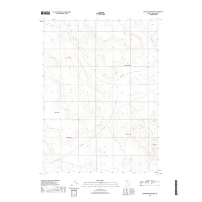
2018 Map of Badger Mountain NW
USGS Topo · Published 2018About this map
Bitner Table and the prominent heights of Badger Mtn define this arid landscape in northwestern Washoe County. This 2018 survey reveals a terrain dominated by intermittent drainage networks and isolated water sources essential for cattle and wildlife in the high desert. The map tracks the winding course of Wall Canyon Cr and Badger Cr, alongside vital watering points like Post Camp Spring and North Spring. Human presence is minimal, largely represented by the foundational surveying grid of the Public Land Survey System and Co Rte 8a, which provides the primary access through the Badger Mountains. The map provides a precise record of the regional topography, showing how these few named landmarks serve as the primary navigation points in an otherwise vast and sparsely populated high-altitude environment.
Find a feature on this map
12 named features on this map. Tap any name to fly to it.
Don’t see what you’re looking for? This feature index may not catch every label — zoom into the map to look around manually.
Map Details
Editions of this 2018 Badger Mountain NW Map
This is the sole edition of this map. No revisions or reprints were ever made.
Other maps of this area

1889 · Long Valley
USGS Topo · 1:250,000

1954 · Vya
USGS Topo · 1:250,000

1958 · Vya
USGS Topo · 1:250,000

1962 · Vya
USGS Topo · 1:250,000

1966 · Bald Mountain
USGS Topo · 1:24,000

1966 · Swan Lake
USGS Topo · 1:24,000

1966 · Badger Mtn NW
USGS Topo · 1:24,000

1966 · Massacre Lake
USGS Topo · 1:24,000

1966 · Blowout Mtn
USGS Topo · 1:24,000

1966 · Nut Mountain
USGS Topo · 1:24,000