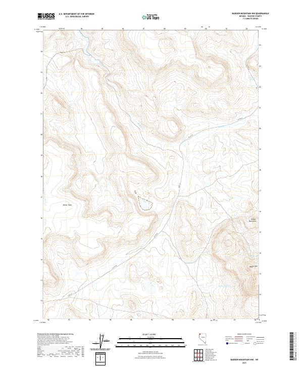
2021 Map of Badger Mountain NW
USGS Topo · Published 2021About this map
Bitner Table and the high peaks of the Badger Mountains dominate this high-desert landscape in northern Washoe County. This modern topographical study captures the remote character of the Great Basin, where water sources like Post Camp Spring and North Spring are critical landmarks for both historic navigation and contemporary land management. The drainage patterns are defined by the seasonal flow of Badger Cr and Wall Canyon Cr, cutting through the volcanic terrain. Connectivity through this corner of Nevada is maintained by Co Rte 8a, which winds through the northwestern corner of the quadrangle. For researchers, the map provides precise section lines and public land survey data, including boundaries for t44n r23e and t43n r22e, reflecting the ongoing organization of these high-altitude plateaus.
Find a feature on this map
12 named features on this map. Tap any name to fly to it.
Don’t see what you’re looking for? This feature index may not catch every label — zoom into the map to look around manually.
Map Details
Editions of this 2021 Badger Mountain NW Map
This is the sole edition of this map. No revisions or reprints were ever made.
Other maps of this area

1889 · Long Valley
USGS Topo · 1:250,000

1954 · Vya
USGS Topo · 1:250,000

1958 · Vya
USGS Topo · 1:250,000

1962 · Vya
USGS Topo · 1:250,000

1966 · Bald Mountain
USGS Topo · 1:24,000

1966 · Swan Lake
USGS Topo · 1:24,000

1966 · Badger Mtn NW
USGS Topo · 1:24,000

1966 · Massacre Lake
USGS Topo · 1:24,000

1966 · Blowout Mtn
USGS Topo · 1:24,000

1966 · Nut Mountain
USGS Topo · 1:24,000