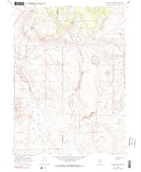
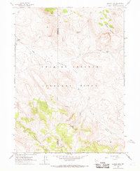
1966 Map of Badger Mtn SE
USGS Topo · Published 1990About this map
The Charles Sheldon Antelope Range dominates this high-desert landscape on the boundary of Washoe and Humboldt counties. This mid-1960s survey documents a rugged network of drainages and seasonal water sources essential for survival in the Great Basin. Deep canyons like Wall Canyon and Little Cottonwood Canyon carve through the volcanic terrain, leading toward the prominent mass of Badger Mountain. The presence of numerous watering points, such as Domingo Spring, Wheeler Spring, and Bateman Spring, suggests the area's importance for wildlife and range management. A lone Prospect located west of Cottonwood Canyon and south of Little Cottonwood Canyon points to the area's geological potential, while the dramatic Wildcat Gorge and the open Shoestring Valley define the local topography. The map illustrates a largely roadless territory, marked only by occasional jeep trails used for access through the high range.
Find a feature on this map
24 named features on this map. Tap any name to fly to it.
Don’t see what you’re looking for? This feature index may not catch every label — zoom into the map to look around manually.
Map Details
Editions of this 1966 Badger Mtn SE Map
3 editions found
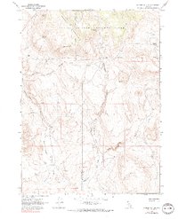
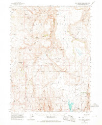
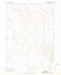
Other maps of this area

1889 · Long Valley
USGS Topo · 1:250,000

1954 · Vya
USGS Topo · 1:250,000

1958 · Vya
USGS Topo · 1:250,000

1962 · Vya
USGS Topo · 1:250,000
1965 · Rock Spring Table
USGS Topo · 1:62,500
1966 · Badger Mtn NW
USGS Topo · 1:24,000
1966 · Blowout Mtn
USGS Topo · 1:24,000
1966 · Nut Mountain
USGS Topo · 1:24,000
1966 · Badger Mtn SE
USGS Topo · 1:24,000
1972 · Soldier Meadow
USGS Topo · 1:24,000