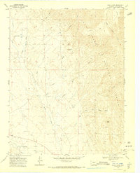
1969 Map of Badito Cone
USGS Topo · Published 1973About this map
The Huerfano River valley serves as the southern anchor for this landscape, where the Huerfano Ditch suggests the vital role of water management in this part of Huerfano County. Rising sharply from the valley floor toward the San Isabel National Forest, the terrain is defined by prominent landmarks such as Badito Cone and Santana Butte. The map documents a scattered human presence through several small burial sites, including Cisneros Cem and Maes Creek Cem, which offer significant value for genealogists tracing early families in the region.
Find a feature on this map
26 named features on this map. Tap any name to fly to it.
Don’t see what you’re looking for? This feature index may not catch every label — zoom into the map to look around manually.
Map Details
Editions of this 1969 Badito Cone Map
3 editions found
Other maps of this area

1889 · Huerfano Park
USGS Topo · 1:125,000

1891 · Walsenburg
USGS Topo · 1:125,000

1892 · Huerfano Park
USGS Topo · 1:125,000

1894 · Walsenburg
USGS Topo · 1:125,000

1897 · Walsenburg
USGS Topo · 1:125,000

1900 · Walsenburg
USGS Topo · 1:125,000

1954 · Trinidad
USGS Topo · 1:250,000

1955 · Trinidad
USGS Topo · 1:250,000

1958 · Trinidad
USGS Topo · 1:250,000

1959 · Trinidad
USGS Topo · 1:250,000