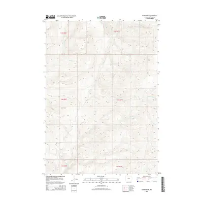
2015 Map of Badwater NE
USGS Topo · Published 2015About this map
Okie Pasture dominates the central landscape of this Wyoming high-country survey, representing the working ranching heritage of the Badwater region. The area is defined by a dense network of seasonal drainages that feed into the larger Badwater Cr system, including the Middle Fork Buffalo Cr and S Fork Buffalo Cr in the east. This topographical detail illustrates the complex watershed management necessary for high-plains grazing.
Find a feature on this map
17 named features on this map. Tap any name to fly to it.
Don’t see what you’re looking for? This feature index may not catch every label — zoom into the map to look around manually.
Map Details
Editions of this 2015 Badwater NE Map
This is the sole edition of this map. No revisions or reprints were ever made.
Other maps of this area

1952 · Deadman Butte
USGS Topo · 1:24,000

1952 · Badwater
USGS Topo · 1:24,000

1952 · Grave Spring
USGS Topo · 1:24,000

1952 · Sioux Pass
USGS Topo · 1:24,000

1952 · Badwater NE
USGS Topo · 1:24,000

1952 · Badwater SE
USGS Topo · 1:24,000

1955 · Arminto
USGS Topo · 1:250,000

1958 · Arminto
USGS Topo · 1:250,000

1962 · Arminto
USGS Topo · 1:250,000
1967 · Cornell Gulch
USGS Topo · 1:24,000