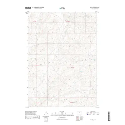
2017 Map of Badwater NE
USGS Topo · Published 2017About this map
Okie Pasture dominates the central landscape of this Natrona County region, where the high plains transition into a network of drainage basins and trails. The map documents a complex hydraulic system including the Middle Fork Buffalo Creek and the southern flow of Badwater Creek. Historically significant routes like the Oakie Trail and Bighorn Trail intersect the terrain, following the natural contours of the land and providing access between remote creek crossings. The numerous named watercourses such as Little Deep Creek and Sawmill Creek indicate a landscape defined by seasonal flow and livestock grazing potential. This 2017 survey by the U.S. Geological Survey captures the enduring path of these upland trails and the established township and range boundaries that have organized this part of Wyoming for generations.
Find a feature on this map
17 named features on this map. Tap any name to fly to it.
Don’t see what you’re looking for? This feature index may not catch every label — zoom into the map to look around manually.
Map Details
Editions of this 2017 Badwater NE Map
This is the sole edition of this map. No revisions or reprints were ever made.
Other maps of this area

1952 · Deadman Butte
USGS Topo · 1:24,000

1952 · Badwater
USGS Topo · 1:24,000

1952 · Grave Spring
USGS Topo · 1:24,000

1952 · Sioux Pass
USGS Topo · 1:24,000

1952 · Badwater NE
USGS Topo · 1:24,000

1952 · Badwater SE
USGS Topo · 1:24,000

1955 · Arminto
USGS Topo · 1:250,000

1958 · Arminto
USGS Topo · 1:250,000

1962 · Arminto
USGS Topo · 1:250,000
1967 · Cornell Gulch
USGS Topo · 1:24,000