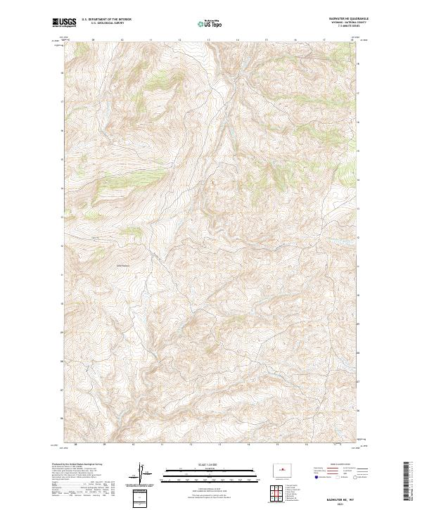
2021 Map of Badwater NE
USGS Topo · Published 2021About this map
High-elevation drainages carve through the central Wyoming landscape in this 2021 study of the Natrona County highlands. This terrain is defined by the steep, winding headwaters of Little Deep Cr and Little Lost Cr, where the topography rises sharply across a series of ridges and draws. These seasonal watercourses reflect the arid, high-plains geography of the region, illustrating the natural drainage patterns that have dictated land use and travel through this part of the state for generations. The lack of modern development emphasizes the persistent nature of the Wyoming backcountry, where the physical landscape remains the primary feature for those navigating the high country.
Find a feature on this map
2 named features on this map. Tap any name to fly to it.
Don’t see what you’re looking for? This feature index may not catch every label — zoom into the map to look around manually.
Map Details
Editions of this 2021 Badwater NE Map
This is the sole edition of this map. No revisions or reprints were ever made.
Other maps of this area

1952 · Deadman Butte
USGS Topo · 1:24,000

1952 · Badwater
USGS Topo · 1:24,000

1952 · Grave Spring
USGS Topo · 1:24,000

1952 · Sioux Pass
USGS Topo · 1:24,000

1952 · Badwater NE
USGS Topo · 1:24,000

1952 · Badwater SE
USGS Topo · 1:24,000

1955 · Arminto
USGS Topo · 1:250,000

1958 · Arminto
USGS Topo · 1:250,000

1962 · Arminto
USGS Topo · 1:250,000
1967 · Cornell Gulch
USGS Topo · 1:24,000