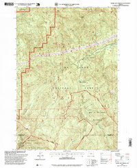
1997 Map of Bagby Hot Springs
USGS Topo · Published 1999About this map
Bagby Hot Springs lies at the heart of this mountain landscape within the Mt Hood National Forest, marking a unique hydrothermal feature where the terrain drops toward the Collawash River. This late-1990s survey delineates the boundary between Clackamas and Marion counties, showing a region defined by high peaks like Baty Butte and Thunder Mountain. The map illustrates the specialized recreational and industrial infrastructure of the era, from the Pegleg Falls (Day Use Area) to the Hugh Creek Quarry.
Find a feature on this map
30 named features on this map. Tap any name to fly to it.
Don’t see what you’re looking for? This feature index may not catch every label — zoom into the map to look around manually.
Map Details
Editions of this 1997 Bagby Hot Springs Map
This is the sole edition of this map. No revisions or reprints were ever made.
Other maps of this area

1916 · Estacada
USGS Topo · 1:125,000

1929 · Mill City
USGS Topo · 1:125,000

1948 · Vancouver
USGS Topo · 1:250,000

1950 · Vancouver
USGS Topo · 1:250,000

1950 · Vancouver
USGS Topo · 1:250,000

1953 · Salem
USGS Topo · 1:250,000

1954 · Salem
USGS Topo · 1:250,000

1955 · Colton
USGS Topo · 1:62,500

1955 · Mill City
USGS Topo · 1:62,500

1956 · Fish Creek Mtn
USGS Topo · 1:62,500