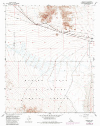
1954 Map of Bagdad SW
USGS Topo · Published 1985About this map
The Atchison Topeka and Santa Fe railroad cuts across the Mojave Desert floor, serving as the primary infrastructure artery for this isolated San Bernardino County landscape. This mid-century survey, updated in the 1980s, documents the transition of the desert into military use, as much of the southern terrain is occupied by the Marine Corps Air Ground Combat Center. The northern portion of the map features the remnant locations of former desert outposts, specifically Bagdad and the former location of Trojan. To the west, the Naval Reservation Boundary borders the rugged slopes of the Bullion Mts. While industrial infrastructure like the Pipeline and Dike suggests modern utility, a lone Prospect near the base of the mountains points to the area's older history of mineral exploration.
Find a feature on this map
12 named features on this map. Tap any name to fly to it.
Don’t see what you’re looking for? This feature index may not catch every label — zoom into the map to look around manually.
Map Details
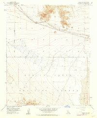
Editions of this 1954 Bagdad SW Map
3 editions found
Other maps of this area

1942 · Amboy
USGS Topo · 1:250,000

1943 · Amboy
USGS Topo · 1:250,000

1953 · San Bernardino
USGS Topo · 1:250,000

1954 · Needles
USGS Topo · 1:250,000

1954 · Amboy Crater
USGS Topo · 1:24,000

1954 · Bagdad SW
USGS Topo · 1:24,000

1954 · Ludlow SE
USGS Topo · 1:24,000

1955 · Lead Mountain
USGS Topo · 1:24,000

1955 · Lead Mtn. NE
USGS Topo · 1:24,000

1955 · Deadman Lake NE
USGS Topo · 1:24,000