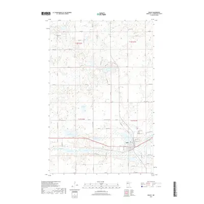
2019 Map of Bagley
USGS Topo · Published 2019About this map
Bagley serves as the central hub of this Clearwater County landscape, situated where the Clearwater River flows through a series of significant water bodies including First Lake, Second Lake, and Lake Lomond. The settlement pattern reflects a deeply rooted community, marked by numerous burial grounds such as Bagley Cem, Saint Joseph Cem, and Gran Cem that dot the surrounding townships. The northern reaches are characterized by a dense network of glacial lakes and wetlands, with Hegre Lake, Lost Lake, and Willborg Lake defining the local hydrology.
Find a feature on this map
87 named features on this map. Tap any name to fly to it.
Don’t see what you’re looking for? This feature index may not catch every label — zoom into the map to look around manually.
Map Details
Editions of this 2019 Bagley Map
This is the sole edition of this map. No revisions or reprints were ever made.
Other maps of this area

1919 · Fosston
USGS Topo · 1:62,500

1943 · Bagley
USGS Topo · 1:62,500

1954 · Bemidji
USGS Topo · 1:250,000

1957 · Bemidji
USGS Topo · 1:250,000

1958 · Bemidji
USGS Topo · 1:250,000

1969 · Ebro
USGS Topo · 1:24,000

1969 · Clearbrook
USGS Topo · 1:24,000

1969 · Leonard
USGS Topo · 1:24,000

1969 · Fosston SE
USGS Topo · 1:24,000

1969 · Gonvick
USGS Topo · 1:24,000