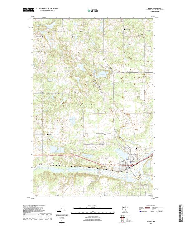
2022 Map of Bagley
USGS Topo · Published 2022About this map
Bagley serves as the focal point of this Clearwater County survey, situated at the junction of the Clearwater River and several local water bodies. The presence of the Clearwater County Courthouse underscores the town's importance as a regional administrative center. The surrounding landscape is defined by a glacial topography of scattered lakes and marshes, including Lake Lomond, Willborg Lake, and Monson Lake. The map reveals a dense network of local cemeteries, such as Saint Joseph Cem, Bagley Cem, and Zion Cem, which provide significant touchstones for genealogical research in this part of Minnesota. The hydrological pattern is intricate, with Walker Brook and Silver Cr feeding into larger systems, reflecting the natural drainage of the North Woods region. Section lines from t148n r38w and t148n r37w illustrate the systematic township and range organization that guided the settlement of these northern prairies and woodlands.
Find a feature on this map
75 named features on this map. Tap any name to fly to it.
Don’t see what you’re looking for? This feature index may not catch every label — zoom into the map to look around manually.
Map Details
Editions of this 2022 Bagley Map
This is the sole edition of this map. No revisions or reprints were ever made.
Other maps of this area

1919 · Fosston
USGS Topo · 1:62,500

1943 · Bagley
USGS Topo · 1:62,500

1954 · Bemidji
USGS Topo · 1:250,000

1957 · Bemidji
USGS Topo · 1:250,000

1958 · Bemidji
USGS Topo · 1:250,000

1969 · Ebro
USGS Topo · 1:24,000

1969 · Clearbrook
USGS Topo · 1:24,000

1969 · Leonard
USGS Topo · 1:24,000

1969 · Fosston SE
USGS Topo · 1:24,000

1969 · Gonvick
USGS Topo · 1:24,000