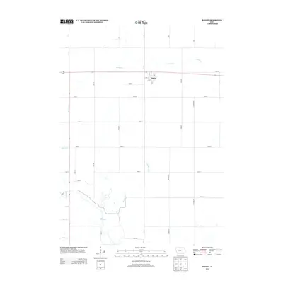
2013 Map of Bagley
USGS Topo · Published 2013About this map
Bagley serves as the central hub of this Guthrie County landscape, situated along the northern corridor where Highway 141 and the local grid of streets like Main St and 5th St define the town's footprint. The surrounding countryside is a geometric arrangement of section lines and gravel roads, including Quail Rd and Rose Ave, which cross a drainage network dominated by Mosquito Creek and Springbrook Creek. To the southwest, the terrain transitions toward the residential and recreational fringes of Lake Panorama, while the name Moffits Grove recalls an earlier settlement era near the water's edge. This 2013 survey provides a clear view of the intersection between established rural townships and modern developments near the Raccoon River watershed.
Find a feature on this map
43 named features on this map. Tap any name to fly to it.
Don’t see what you’re looking for? This feature index may not catch every label — zoom into the map to look around manually.
Map Details
Editions of this 2013 Bagley Map
This is the sole edition of this map. No revisions or reprints were ever made.
Other maps of this area

1952 · Panora
USGS Topo · 1:62,500

1954 · Bagley
USGS Topo · 1:62,500

1954 · Omaha
USGS Topo · 1:250,000

1957 · Omaha
USGS Topo · 1:250,000

1958 · Omaha
USGS Topo · 1:250,000

1971 · Coon Rapids NE
USGS Topo · 1:24,000

1971 · Bayard
USGS Topo · 1:24,000

1971 · Guthrie Center West
USGS Topo · 1:24,000

1982 · Guthrie Center East
USGS Topo · 1:24,000

1982 · Panora
USGS Topo · 1:24,000