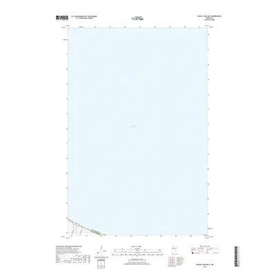
2019 Map of Bagley Lake OE N
USGS Topo · Published 2019About this map
Lower Red Lake dominates this northern Minnesota landscape, where the vast expanse of the basin meets the southern shoreline in the Beltrami Co and Clearwater Co borderlands. The map focuses on the open water and the narrow terrestrial fringe along the southern edge, where the Sandy River flows into the lake. This shoreline is marked by early 21st-century infrastructure, specifically the reservation road network represented by Resvn Hwy 3 and Resvn Hwy 6. The geography highlights the critical intersection of aquatic and terrestrial ecosystems within the Red Lake reservation lands, providing a clear view of the hydraulic patterns and transportation corridors as they existed in 2019.
Find a feature on this map
5 named features on this map. Tap any name to fly to it.
Don’t see what you’re looking for? This feature index may not catch every label — zoom into the map to look around manually.
Map Details
Editions of this 2019 Bagley Lake OE N Map
This is the sole edition of this map. No revisions or reprints were ever made.
Other maps of this area

1918 · Jelle
USGS Topo · 1:62,500

1919 · Churnes
USGS Topo · 1:62,500

1954 · Bemidji
USGS Topo · 1:250,000

1954 · Roseau
USGS Topo · 1:250,000

1957 · Roseau
USGS Topo · 1:250,000

1957 · Bemidji
USGS Topo · 1:250,000

1958 · Bemidji
USGS Topo · 1:250,000

1958 · Roseau
USGS Topo · 1:250,000

1972 · Bagley Lake
USGS Topo · 1:24,000
1972 · Red Lake
USGS Topo · 1:24,000