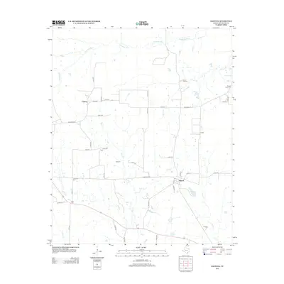
2012 Map of Bagwell
USGS Topo · Published 2012About this map
Bagwell serves as the central hub of this Red River County landscape, positioned along the southern stretch of Farm Road 2573. The map reveals a rural geography defined by a complex network of waterways, including the meandering Denwiddie Bayou in the north and several creeks such as Bruton Cr and Scatter Cr that drain the central plains. Smaller community centers like Midway and Bluff are connected by a grid of county roads, reflecting the persistent agrarian layout of the region. Genealogists will find significant value in the distribution of family and community burial grounds, from Youngs Chapel Cem in the east to Longstreet Cem further west. The landscape is also marked by Brooks Lake, providing a distinct contrast to the surrounding creeks and bayous that have long influenced the settlement patterns and road placements throughout this part of Northeast Texas.
Find a feature on this map
48 named features on this map. Tap any name to fly to it.
Don’t see what you’re looking for? This feature index may not catch every label — zoom into the map to look around manually.
Map Details
Editions of this 2012 Bagwell Map
This is the sole edition of this map. No revisions or reprints were ever made.
Other maps of this area

1951 · Negley
USGS Topo · 1:24,000

1951 · Woodland
USGS Topo · 1:24,000

1951 · Manchester
USGS Topo · 1:24,000

1953 · Texarkana
USGS Topo · 1:250,000

1956 · Texarkana
USGS Topo · 1:250,000

1964 · Detroit
USGS Topo · 1:24,000

1964 · Deport
USGS Topo · 1:24,000

1964 · Bagwell
USGS Topo · 1:24,000
1964 · Dimple
USGS Topo · 1:24,000
1964 · Line Branch
USGS Topo · 1:24,000