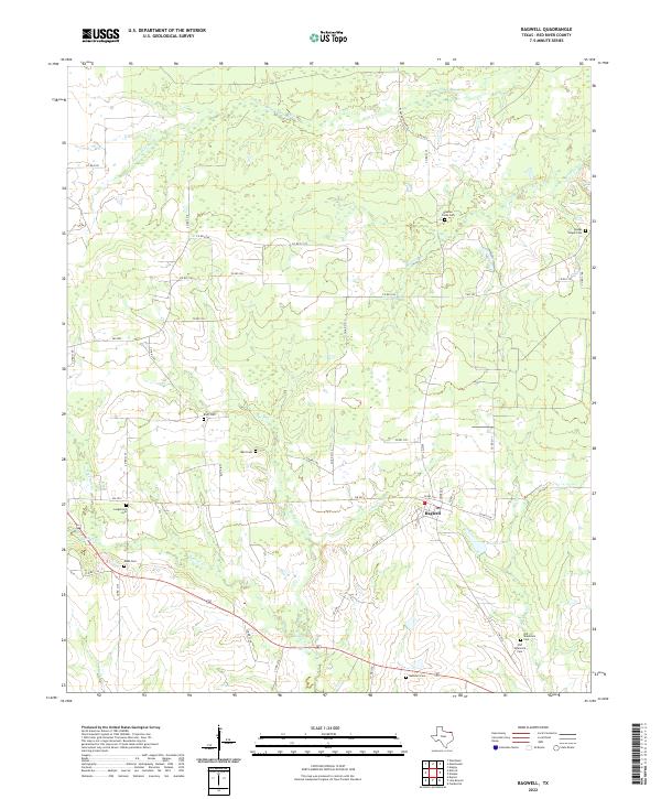
2022 Map of Bagwell
USGS Topo · Published 2022About this map
Bagwell serves as the primary hub in this Red River County landscape, where the terrain is defined by a dense network of meandering waterways. The drainage patterns of Dinwiddie Bayou and Blanton Cr create a complex geography of small valleys and ridges, typical of the blackland prairie and post oak savannah transition. This 2022 U.S. Geological Survey representation reveals a high concentration of family and community burial grounds, such as Becknell Cem and Old Shamrock Cem, which are vital for genealogical research in this part of East Texas.
Find a feature on this map
49 named features on this map. Tap any name to fly to it.
Don’t see what you’re looking for? This feature index may not catch every label — zoom into the map to look around manually.
Map Details
Editions of this 2022 Bagwell Map
This is the sole edition of this map. No revisions or reprints were ever made.
Other maps of this area

1951 · Negley
USGS Topo · 1:24,000

1951 · Woodland
USGS Topo · 1:24,000

1951 · Manchester
USGS Topo · 1:24,000

1953 · Texarkana
USGS Topo · 1:250,000

1956 · Texarkana
USGS Topo · 1:250,000

1964 · Detroit
USGS Topo · 1:24,000

1964 · Deport
USGS Topo · 1:24,000

1964 · Bagwell
USGS Topo · 1:24,000
1964 · Dimple
USGS Topo · 1:24,000
1964 · Line Branch
USGS Topo · 1:24,000