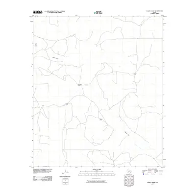
2010 Map of Bailey Draw
USGS Topo · Published 2010About this map
Devils River Draw and Buckhorn Draw define the drainage patterns of this arid landscape in Crockett County. The 2010 survey illustrates a region largely shaped by historic landholdings, where sparse settlements are centered on established ranching operations. Notable sites include Bailey Ranch, Willoughby Ranch, and Baugh Ranch, each serving as local landmarks in an area dominated by dry watercourses. The transportation network is minimal, consisting primarily of rural routes such as Powell Rd and secondary paths like 1193 and 1794, which connect the scattered homesteads. The map provides a detailed view of the terrain's subtle elevation changes, where the intersection of Bailey Draw and Buckhorn Draw creates a distinct natural network within the ranching country.
Find a feature on this map
10 named features on this map. Tap any name to fly to it.
Don’t see what you’re looking for? This feature index may not catch every label — zoom into the map to look around manually.
Map Details
Editions of this 2010 Bailey Draw Map
This is the sole edition of this map. No revisions or reprints were ever made.
Other maps of this area

1954 · Sonora
USGS Topo · 1:250,000

1958 · Sonora
USGS Topo · 1:250,000

1964 · Oglesby Ranch
USGS Topo · 1:24,000

1964 · Coupe Ranch
USGS Topo · 1:24,000

1964 · Bailey Draw
USGS Topo · 1:24,000

1964 · Moore Ranch
USGS Topo · 1:24,000

1967 · Nolen Draw
USGS Topo · 1:24,000

1967 · Savell Ranch
USGS Topo · 1:24,000

1967 · Double Mill Draw SE
USGS Topo · 1:24,000

1967 · Crockett Heights
USGS Topo · 1:24,000