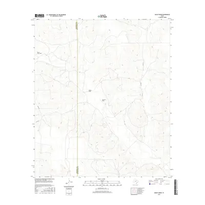
2016 Map of Bailey Draw
USGS Topo · Published 2016About this map
Devils River Draw carves a path through this West Texas landscape along the western edge of the Edward's Plateau, defining the drainage patterns of this sparsely settled ranching territory. The terrain is marked by a network of seasonal watercourses, including Bailey Draw and Buckhorn Draw, which highlight the complex topography where the Crockett Co and Schleicher Co line bisects the region. Human imprint here is limited to a sparse grid of gravel and ranch roads such as Powell Rd and Taylor Rd, providing essential connectivity between distant livestock operations. The contour lines reveal the dramatic relief of the draws as they cut through the plateau, offering a clear view of the natural hydrology that dictates life and land use in this arid portion of the state.
Find a feature on this map
8 named features on this map. Tap any name to fly to it.
Don’t see what you’re looking for? This feature index may not catch every label — zoom into the map to look around manually.
Map Details
Editions of this 2016 Bailey Draw Map
This is the sole edition of this map. No revisions or reprints were ever made.
Other maps of this area

1954 · Sonora
USGS Topo · 1:250,000

1958 · Sonora
USGS Topo · 1:250,000

1964 · Oglesby Ranch
USGS Topo · 1:24,000

1964 · Coupe Ranch
USGS Topo · 1:24,000

1964 · Bailey Draw
USGS Topo · 1:24,000

1964 · Moore Ranch
USGS Topo · 1:24,000

1967 · Nolen Draw
USGS Topo · 1:24,000

1967 · Savell Ranch
USGS Topo · 1:24,000

1967 · Double Mill Draw SE
USGS Topo · 1:24,000

1967 · Crockett Heights
USGS Topo · 1:24,000