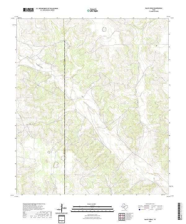
2022 Map of Bailey Draw
USGS Topo · Published 2022About this map
The boundary between Crockett Co and Schleicher Co runs vertically through this expanse of West Texas ranch land, where the drainage patterns of the Edwards Plateau define the geography. The primary watercourses are Bailey Draw and Buckhorn Draw, which channel seasonal runoff through a series of limestone breaks and draws typical of this semi-arid region. Human presence is sparse, marked primarily by a handful of rural routes including Powell Rd and Taylor Rd that connect isolated ranching outposts. The map reveals the intricate contouring of the limestone hills, which reach elevations over 2,450 feet, illustrating the natural obstacles faced by early settlers in these Texas borderlands. This topographic detail serves researchers tracking land use and property boundaries along the county line, where traditional ranching remain the dominant footprint on the landscape.
Find a feature on this map
10 named features on this map. Tap any name to fly to it.
Don’t see what you’re looking for? This feature index may not catch every label — zoom into the map to look around manually.
Map Details
Editions of this 2022 Bailey Draw Map
This is the sole edition of this map. No revisions or reprints were ever made.
Other maps of this area

1954 · Sonora
USGS Topo · 1:250,000

1958 · Sonora
USGS Topo · 1:250,000

1964 · Oglesby Ranch
USGS Topo · 1:24,000

1964 · Coupe Ranch
USGS Topo · 1:24,000

1964 · Bailey Draw
USGS Topo · 1:24,000

1964 · Moore Ranch
USGS Topo · 1:24,000

1967 · Nolen Draw
USGS Topo · 1:24,000

1967 · Savell Ranch
USGS Topo · 1:24,000

1967 · Double Mill Draw SE
USGS Topo · 1:24,000

1967 · Crockett Heights
USGS Topo · 1:24,000