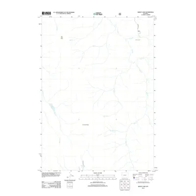
2012 Map of Bailey Lake
USGS Topo · Published 2012About this map
Grayback Ridge anchors this high-elevation landscape in the Bridger-Teton National Forest region, where the drainage systems of Willow Cr and Bailey Cr define the rugged topography. The map illustrates a primarily undeveloped wilderness, punctuated by few human imprints such as Rimrock Ranch near the northern boundary and the primitive reach of Bryan Flat Rd. Hydrographic features are central to the terrain, from the eponymous Bailey Lake to the secluded Waterdog Lake at the southern edge. The presence of Phosphate Cr suggests the area's geological underpinnings, while descriptive landmarks like Pow Wow Point and Lick Cr reflect the naming conventions of early settlers and forest users. The network of creeks, including Mumford Cr and Shepard Cr, illustrates a complex watershed that has shaped the accessibility of these mountain valleys.
Find a feature on this map
18 named features on this map. Tap any name to fly to it.
Don’t see what you’re looking for? This feature index may not catch every label — zoom into the map to look around manually.
Map Details
Editions of this 2012 Bailey Lake Map
This is the sole edition of this map. No revisions or reprints were ever made.
Other maps of this area

1931 · Jackson
USGS Topo · 1:125,000

1935 · Jackson
USGS Topo · 1:125,000

1955 · Driggs
USGS Topo · 1:250,000

1958 · Driggs
USGS Topo · 1:250,000

1962 · Driggs
USGS Topo · 1:250,000

1963 · Munger Mountain
USGS Topo · 1:24,000

1965 · Pickle Pass
USGS Topo · 1:24,000

1965 · Camp Davis
USGS Topo · 1:24,000
1965 · Bailey Lake
USGS Topo · 1:24,000
1965 · Bull Creek
USGS Topo · 1:24,000