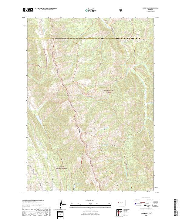
2021 Map of Bailey Lake
USGS Topo · Published 2021About this map
Grayback Ridge and the Wyoming Range dominate this high-altitude landscape along the border of Teton and Lincoln counties. The terrain is defined by a dense network of seasonal drainages and backcountry paths, including the Wyoming Range National Recreation Trl and the Grayback Parallel Trl. These routes follow the natural contours of the land, connecting landmarks such as Pow Wow Point and the secluded Waterdog Lake at the base of the ridge.
Find a feature on this map
43 named features on this map. Tap any name to fly to it.
Don’t see what you’re looking for? This feature index may not catch every label — zoom into the map to look around manually.
Map Details
Editions of this 2021 Bailey Lake Map
This is the sole edition of this map. No revisions or reprints were ever made.
Other maps of this area

1931 · Jackson
USGS Topo · 1:125,000

1935 · Jackson
USGS Topo · 1:125,000

1955 · Driggs
USGS Topo · 1:250,000

1958 · Driggs
USGS Topo · 1:250,000

1962 · Driggs
USGS Topo · 1:250,000

1963 · Munger Mountain
USGS Topo · 1:24,000

1965 · Pickle Pass
USGS Topo · 1:24,000

1965 · Camp Davis
USGS Topo · 1:24,000
1965 · Bailey Lake
USGS Topo · 1:24,000
1965 · Bull Creek
USGS Topo · 1:24,000