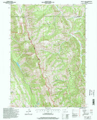
1996 Map of Bailey Lake
USGS Topo · Published 1998About this map
The Wyoming Range and Teton Range converge in this high-elevation wilderness along the Teton County and Lincoln County boundary. The landscape is defined by the Greys River Jackson District, where multiple drainage systems including Willow Creek and Bailey Creek carve through the national forest lands. Local landmarks like the Pow Wow Electronic Point Site and the Rimrock Home indicate isolated human activity within the vast Bridger National Forest and Teton National Forest. Notable water bodies such as Bailey Lake and Waterdog Lake are found tucked into the steep terrain. This 1990s-era topographic study provides a detailed record of the forest trail system, including Trail 142, and small tributary streams like Halfturn Cr and Fullturn Cr that feed the region's larger river systems.
Find a feature on this map
24 named features on this map. Tap any name to fly to it.
Don’t see what you’re looking for? This feature index may not catch every label — zoom into the map to look around manually.
Map Details
Editions of this 1996 Bailey Lake Map
This is the sole edition of this map. No revisions or reprints were ever made.
Other maps of this area

1931 · Jackson
USGS Topo · 1:125,000

1935 · Jackson
USGS Topo · 1:125,000

1955 · Driggs
USGS Topo · 1:250,000

1958 · Driggs
USGS Topo · 1:250,000

1962 · Driggs
USGS Topo · 1:250,000

1963 · Munger Mountain
USGS Topo · 1:24,000

1965 · Pickle Pass
USGS Topo · 1:24,000

1965 · Camp Davis
USGS Topo · 1:24,000
1965 · Bailey Lake
USGS Topo · 1:24,000
1965 · Bull Creek
USGS Topo · 1:24,000