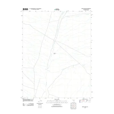
2012 Map of Bailey Wash
USGS Topo · Published 2012About this map
Muleshoe Valley defines this portion of Lincoln County, where the desert floor is carved by a network of drainage systems. The landscape is primarily shaped by the convergence of several major arroyos, including Bailey Wash, which enters from the east, and Coyote Wash, which runs north-to-south through the center of the valley. In the northern reaches of the quadrangle, Maloy Wash cuts across the terrain, illustrating the complex hydrologic patterns of this arid basin. This 2012 survey documents the contemporary road network and drainage alignments in an area defined by its open spaces and intermittent watercourses, providing a clear record of the geographic features that have dictated movement and land use in this part of Nevada for generations.
Find a feature on this map
4 named features on this map. Tap any name to fly to it.
Don’t see what you’re looking for? This feature index may not catch every label — zoom into the map to look around manually.
Map Details
Editions of this 2012 Bailey Wash Map
This is the sole edition of this map. No revisions or reprints were ever made.
Other maps of this area

1915 · Bristol Range
USGS Topo · 1:62,500

1917 · Bristol Range
USGS Topo · 1:62,500

1956 · Lund
USGS Topo · 1:250,000

1960 · Lund
USGS Topo · 1:250,000
1971 · Silver King Mtn SW
USGS Topo · 1:24,000
1971 · Bristol Well
USGS Topo · 1:24,000

1971 · Bailey Wash
USGS Topo · 1:24,000
1971 · Fairview Peak
USGS Topo · 1:24,000

1971 · Silver King Mtn
USGS Topo · 1:24,000

1971 · Sidehill Pass
USGS Topo · 1:24,000