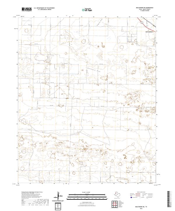
2022 Map of Baileyboro NE
USGS Topo · Published 2022About this map
Muleshoe anchors the northeastern corner of this West Texas landscape, where the town's street grid meets the diagonal path of Railroad Ave. The terrain is defined by the ephemeral watercourses of Blackwater Draw and Progress Draw, which wind through a vast system of agricultural plots and ranch lands. This 2022 survey reveals a highly organized rural infrastructure, dominated by an extensive network of county roads such as Co Rd 103 and Co Rd 113 that segment the High Plains into a rigid geometric pattern. The presence of these draws suggests the natural drainage routes of the Llano Estacado, cutting subtle depressions across the plateau. State-maintained farm-to-market roads like FM 1760 and FM 746 provide the primary transit corridors connecting these remote homesteads and farms to the regional hub at Muleshoe.
Find a feature on this map
26 named features on this map. Tap any name to fly to it.
Don’t see what you’re looking for? This feature index may not catch every label — zoom into the map to look around manually.
Map Details
Editions of this 2022 Baileyboro NE Map
This is the sole edition of this map. No revisions or reprints were ever made.
Other maps of this area

1954 · Clovis
USGS Topo · 1:250,000

1958 · Clovis
USGS Topo · 1:250,000

1962 · Muleshoe
USGS Topo · 1:24,000

1962 · Needmore
USGS Topo · 1:24,000

1962 · Stegall
USGS Topo · 1:24,000

1962 · Birdwell Ranch
USGS Topo · 1:24,000

1962 · Baileyboro NE
USGS Topo · 1:24,000

1962 · Baileyboro
USGS Topo · 1:24,000

1963 · Lariat
USGS Topo · 1:24,000

1963 · Lazbuddie SW
USGS Topo · 1:24,000