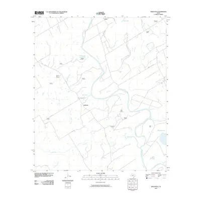
2010 Map of Baileyville
USGS Topo · Published 2010About this map
Brazos River meanders through the heart of this East Texas landscape, creating a complex network of oxbows and sloughs that define local land use and boundaries. The settlement of Baileyville serves as a central point in this rural area, which is deeply rooted in its local history and family heritage as evidenced by the high concentration of named burial sites. Scattered throughout the quadrangle are numerous family and community landmarks, including Macedonia Cemetery and Stoneham Cemetery.
Find a feature on this map
38 named features on this map. Tap any name to fly to it.
Don’t see what you’re looking for? This feature index may not catch every label — zoom into the map to look around manually.
Map Details
Editions of this 2010 Baileyville Map
This is the sole edition of this map. No revisions or reprints were ever made.
Other maps of this area

1954 · Waco
USGS Topo · 1:250,000

1954 · Austin
USGS Topo · 1:250,000

1955 · Waco
USGS Topo · 1:250,000

1961 · Baileyville
USGS Topo · 1:24,000

1962 · Calvert
USGS Topo · 1:24,000

1962 · Maysfield
USGS Topo · 1:24,000

1962 · Rosebud
USGS Topo · 1:24,000

1962 · Hammond
USGS Topo · 1:24,000

1962 · Reagan
USGS Topo · 1:24,000
1962 · Ben Arnold
USGS Topo · 1:24,000