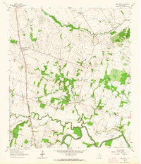
1962 Map of Ben Arnold
USGS Topo · Published 1964About this map
The Southern Pacific railroad corridor anchors the western edge of this 1960s Milam County landscape, cutting through a series of small agricultural communities. The settlement of Ben Arnold serves as a local focal point, while the surrounding countryside is dotted with sites of genealogical significance, including Elm Grove Cem and Vogelsang Cem. Further south, the terrain descends toward the Little River, where the confluence of Big Elm Creek and North Elm Cr shapes the lowland geography.
Find a feature on this map
27 named features on this map. Tap any name to fly to it.
Don’t see what you’re looking for? This feature index may not catch every label — zoom into the map to look around manually.
Map Details
Editions of this 1962 Ben Arnold Map
2 editions found
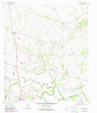
Other maps of this area

1885 · Taylor
USGS Topo · 1:125,000

1887 · Taylor
USGS Topo · 1:125,000

1892 · Temple
USGS Topo · 1:125,000

1894 · Taylor
USGS Topo · 1:125,000

1954 · Waco
USGS Topo · 1:250,000

1954 · Austin
USGS Topo · 1:250,000

1955 · Waco
USGS Topo · 1:250,000

1961 · Hanover
USGS Topo · 1:24,000

1961 · Cameron
USGS Topo · 1:24,000

1961 · Baileyville
USGS Topo · 1:24,000