
1961 Map of Hanover
USGS Topo · Published 1964About this map
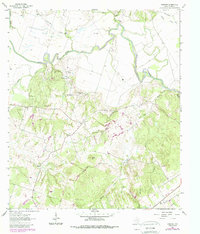
The Little River winds through the northern reaches of this Milam County landscape, creating a complex series of meanders and oxbows that define the local geography in the early 1960s. South of the river, the terrain rises toward Wilson Hill, where a network of small creeks and branches like Jess Hood Creek and Yellow Rabbit Branch carve through the countryside. This era shows a well-distributed rural community centered around the settlements of Hanover and Liberty, with local life anchored by landmarks such as White Oak Ridge Ch and Coxes Providence Ch.
Find a feature on this map
29 named features on this map. Tap any name to fly to it.
Don’t see what you’re looking for? This feature index may not catch every label — zoom into the map to look around manually.
Map Details
Editions of this 1961 Hanover Map
2 editions found
Other maps of this area

1954 · Austin
USGS Topo · 1:250,000

1956 · Caldwell
USGS Topo · 1:62,500

1956 · Milano
USGS Topo · 1:62,500

1961 · Cameron
USGS Topo · 1:24,000

1961 · Rockdale East
USGS Topo · 1:24,000

1962 · Goodwill
USGS Topo · 1:24,000

1962 · Calvert
USGS Topo · 1:24,000

1962 · Maysfield
USGS Topo · 1:24,000
1962 · Ben Arnold
USGS Topo · 1:24,000
1962 · Gause
USGS Topo · 1:24,000