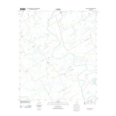
2013 Map of Baileyville
USGS Topo · Published 2013About this map
The Brazos River meanders through this portion of Milam County, creating a landscape of sloughs and oxbow lakes such as Ellison Lake, Burns Lake, and Robertson Lake. The rural character of the region is defined by scattered farmsteads and small communities like Baileyville and Eloise, connected by a network of farm-to-market roads and county routes. To the east, the Little Brazos River Diversion Channel redirects flow near Salter Farm, illustrating modern hydraulic management of the river system.
Find a feature on this map
55 named features on this map. Tap any name to fly to it.
Don’t see what you’re looking for? This feature index may not catch every label — zoom into the map to look around manually.
Map Details
Editions of this 2013 Baileyville Map
This is the sole edition of this map. No revisions or reprints were ever made.
Other maps of this area

1954 · Waco
USGS Topo · 1:250,000

1954 · Austin
USGS Topo · 1:250,000

1955 · Waco
USGS Topo · 1:250,000

1961 · Baileyville
USGS Topo · 1:24,000

1962 · Calvert
USGS Topo · 1:24,000

1962 · Maysfield
USGS Topo · 1:24,000

1962 · Rosebud
USGS Topo · 1:24,000

1962 · Hammond
USGS Topo · 1:24,000

1962 · Reagan
USGS Topo · 1:24,000
1962 · Ben Arnold
USGS Topo · 1:24,000