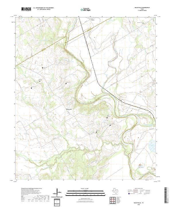
2022 Map of Baileyville
USGS Topo · Published 2022About this map
Brazos River meanders through the heart of this central Texas landscape, marking the complex borders where Falls, Milam, and Robertson counties converge. The small settlement of Baileyville serves as a central point in an area defined by agricultural land and oxbow features like Burns Lake and Ellison Lake. This 2022 survey captures a rural territory densely populated with family and community burial grounds, reflecting generations of local residency. Notable sites include Macedonia Cem in the northeast and several others clustered south of the river, such as Stoneham Cem and Allday-Jones Cem. The presence of the Little Brazos River Diversion Channel and Robertson Lake near the eastern margin highlights the sophisticated water management and historical drainage patterns of the Brazos valley.
Find a feature on this map
49 named features on this map. Tap any name to fly to it.
Don’t see what you’re looking for? This feature index may not catch every label — zoom into the map to look around manually.
Map Details
Editions of this 2022 Baileyville Map
This is the sole edition of this map. No revisions or reprints were ever made.
Other maps of this area

1954 · Waco
USGS Topo · 1:250,000

1954 · Austin
USGS Topo · 1:250,000

1955 · Waco
USGS Topo · 1:250,000

1961 · Baileyville
USGS Topo · 1:24,000

1962 · Calvert
USGS Topo · 1:24,000

1962 · Maysfield
USGS Topo · 1:24,000

1962 · Rosebud
USGS Topo · 1:24,000

1962 · Hammond
USGS Topo · 1:24,000

1962 · Reagan
USGS Topo · 1:24,000
1962 · Ben Arnold
USGS Topo · 1:24,000