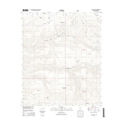
2013 Map of Baily Points
USGS Topo · Published 2013About this map
McCauley Ranch and the high ridges of the Black Range characterize this 2013 topographic study of the Gila National Forest. The landscape is defined by its arid-land water management, featuring a dense network of catchments such as Shallow Tank, Upper Dry Tank, and Inman Cienega Tank used to support livestock and wildlife in a region marked by deep drainages like Alexander Canyon and Seventyfour Draw. The high points of Baily Points and the distinct volcanic profile of Round Mtn provide essential landmarks for navigation across the high desert terrain.
Find a feature on this map
34 named features on this map. Tap any name to fly to it.
Don’t see what you’re looking for? This feature index may not catch every label — zoom into the map to look around manually.
Map Details
Editions of this 2013 Baily Points Map
This is the sole edition of this map. No revisions or reprints were ever made.
Other maps of this area

1911 · Alum Mountain
USGS Topo · 1:125,000

1913 · Alum Mountain
USGS Topo · 1:125,000

1949 · Lookout Mountain
USGS Topo · 1:62,500

1954 · Tularosa
USGS Topo · 1:250,000

1954 · Clifton
USGS Topo · 1:250,000

1957 · Clifton
USGS Topo · 1:250,000

1958 · Clifton
USGS Topo · 1:250,000

1958 · Tularosa
USGS Topo · 1:250,000

1962 · Clifton
USGS Topo · 1:250,000

1963 · Bonner Canyon
USGS Topo · 1:24,000