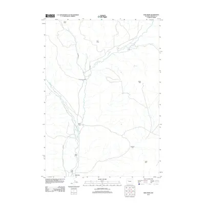
2012 Map of Bain Draw
USGS Topo · Published 2012About this map
The E Fork Wind River and Wiggins Fork converge in this high-plains landscape of Fremont County, Wyoming, as documented in 2012. The map reveals a land structured by water and elevation, where the Circle Ditch illustrates the vital role of irrigation in the arid West. Named ranching homesteads such as the Finley Ranch, Double Diamond Ranch, and Bain Place are positioned near these water sources, reflecting the enduring cattle and ranching heritage of the region. The topography is defined by significant flat-topped features including Upper Table and Lower Table, which overlook a series of erosional channels like Lake Draw, Bain Draw, and Pease Draw. This specific area shows how modern ranching infrastructure follows the natural drainage patterns of Bear Cr and Spear Cr, maintaining a pattern of settlement established by early twentieth-century land claims.
Find a feature on this map
19 named features on this map. Tap any name to fly to it.
Don’t see what you’re looking for? This feature index may not catch every label — zoom into the map to look around manually.
Map Details
Editions of this 2012 Bain Draw Map
This is the sole edition of this map. No revisions or reprints were ever made.
Other maps of this area

1904 · Kirwin
USGS Topo · 1:125,000

1905 · Younts Peak
USGS Topo · 1:125,000

1906 · Kirwin
USGS Topo · 1:125,000

1907 · Younts Peak
USGS Topo · 1:125,000

1909 · Fremont Peak
USGS Topo · 1:125,000

1952 · Wilderness
USGS Topo · 1:24,000

1952 · Blue Holes
USGS Topo · 1:24,000

1955 · Thermopolis
USGS Topo · 1:250,000

1956 · Indian Point
USGS Topo · 1:24,000

1956 · Mason Draw
USGS Topo · 1:24,000