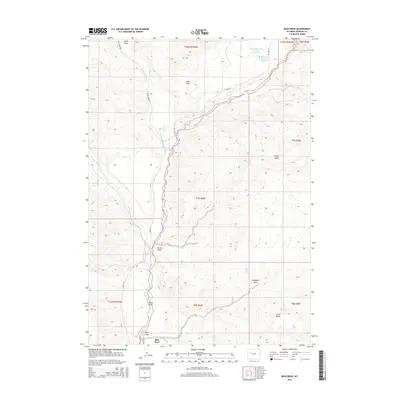
2015 Map of Bain Draw
USGS Topo · Published 2015About this map
The East Fork Wind River carves a deep valley through this Fremont County landscape, meeting the Wiggins Fork in a region defined by high mesas and seasonal drainages. Modern ranching and water management are evident at Bain Place and the Circle Ditch system, which redirects alpine runoff toward the agricultural flats. Notable landmarks include the Upper Table and Lower Table, prominent landforms that rise above the winding riverbed. High-altitude water storage is marked by the Double Diamond Number 1 Reservoir and Bitterroot Number 1 Reservoir in the northern reaches. The area is intersected by several named draws, such as Horse Draw and Pease Draw, which channel snowmelt from the surrounding ridges. For researchers, the map provides a clear picture of the 21st-century road network, including Bear Creek Rd and E Fork Rd, which provide access to this high-country terrain.
Find a feature on this map
26 named features on this map. Tap any name to fly to it.
Don’t see what you’re looking for? This feature index may not catch every label — zoom into the map to look around manually.
Map Details
Editions of this 2015 Bain Draw Map
This is the sole edition of this map. No revisions or reprints were ever made.
Other maps of this area

1904 · Kirwin
USGS Topo · 1:125,000

1905 · Younts Peak
USGS Topo · 1:125,000

1906 · Kirwin
USGS Topo · 1:125,000

1907 · Younts Peak
USGS Topo · 1:125,000

1909 · Fremont Peak
USGS Topo · 1:125,000

1952 · Wilderness
USGS Topo · 1:24,000

1952 · Blue Holes
USGS Topo · 1:24,000

1955 · Thermopolis
USGS Topo · 1:250,000

1956 · Indian Point
USGS Topo · 1:24,000

1956 · Mason Draw
USGS Topo · 1:24,000