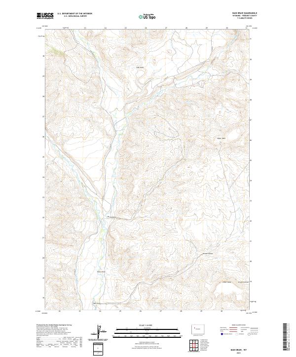
2021 Map of Bain Draw
USGS Topo · Published 2021About this map
The East Fork Wind River carves a deep path through this portion of Fremont County, creating a dramatic landscape of high mesas and drainage basins. Two prominent plateau formations, Upper Table and Lower Table, overlook the river system, while numerous named draws like Bain Draw and Pease Draw reveal the complex hydrology of this high-elevation terrain. These features illustrate the natural erosion patterns that define the region's geography.
Find a feature on this map
23 named features on this map. Tap any name to fly to it.
Don’t see what you’re looking for? This feature index may not catch every label — zoom into the map to look around manually.
Map Details
Editions of this 2021 Bain Draw Map
This is the sole edition of this map. No revisions or reprints were ever made.
Other maps of this area

1904 · Kirwin
USGS Topo · 1:125,000

1905 · Younts Peak
USGS Topo · 1:125,000

1906 · Kirwin
USGS Topo · 1:125,000

1907 · Younts Peak
USGS Topo · 1:125,000

1909 · Fremont Peak
USGS Topo · 1:125,000

1952 · Wilderness
USGS Topo · 1:24,000

1952 · Blue Holes
USGS Topo · 1:24,000

1955 · Thermopolis
USGS Topo · 1:250,000

1956 · Indian Point
USGS Topo · 1:24,000

1956 · Mason Draw
USGS Topo · 1:24,000