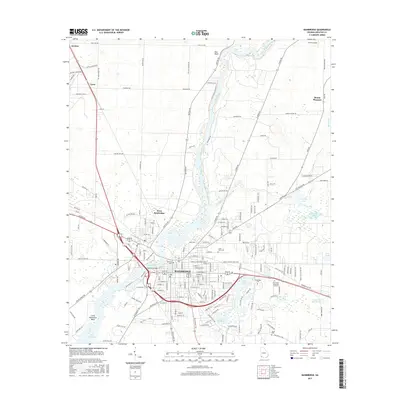
2017 Map of Bainbridge
USGS Topo · Published 2017About this map
The Flint River defines the geography of this Decatur County seat, curving past Bainbridge and West Bainbridge before entering the northern reaches of Lake Seminole at Little Horseshoe Bend. The city's residential and commercial grid is dense with local history, including several significant burial grounds such as Oak City Cem and the Jonas Lobe Cem. To the east, Bainbridge Coll sits near Twin Lakes, while the surrounding landscape is marked by numerous water bodies like Lake Douglas and the meandering Big Slough. Transport and commerce are evidenced by the CSX railroad lines and a network of rural roads connecting outlying settlements like Lynn, Mount Pleasant, and Ausmac. The map details the transition from the concentrated urban center to the hydraulic landscape of ponds and sloughs that characterizes this part of Southwest Georgia.
Find a feature on this map
174 named features on this map. Tap any name to fly to it.
Don’t see what you’re looking for? This feature index may not catch every label — zoom into the map to look around manually.
Map Details
Editions of this 2017 Bainbridge Map
This is the sole edition of this map. No revisions or reprints were ever made.
Other maps of this area

1953 · Dothan
USGS Topo · 1:250,000

1954 · Dothan
USGS Topo · 1:250,000

1954 · Tallahassee
USGS Topo · 1:250,000

1955 · Dothan
USGS Topo · 1:250,000

1955 · Bainbridge
USGS Topo · 1:62,500

1955 · Whigham
USGS Topo · 1:62,500

1959 · Tallahassee
USGS Topo · 1:250,000

1960 · Tallahassee
USGS Topo · 1:250,000

1971 · Vada
USGS Topo · 1:24,000

1974 · Boykin
USGS Topo · 1:24,000