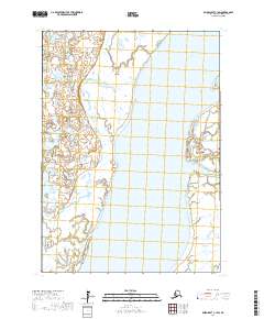
2017 Map of Baird Inlet C-1 SW
USGS Topo · Published 2017About this map
The Kuskokwim River dominates this portion of the Yukon-Kuskokwim Delta, cutting a massive path through a landscape defined by water and saturated wetlands. This 2017 survey illustrates the complex hydrology of the region near Bethel, where the main river channel interacts with smaller offshoots like Lomavik Slough. The area is part of a vast, low-lying drainage system where land and water are constantly shifting. Aside from the primary river channels, the map consists almost entirely of marshland and unnamed ponds, reflecting the remote and undeveloped character of this Alaskan wilderness. Boundary lines for sections such as t6n r74w and t5n r74w provide the only formal structure to a territory otherwise governed by the natural movements of the Kuskokwim.
Find a feature on this map
6 named features on this map. Tap any name to fly to it.
Don’t see what you’re looking for? This feature index may not catch every label — zoom into the map to look around manually.
Map Details
Editions of this 2017 Baird Inlet C-1 SW Map
This is the sole edition of this map. No revisions or reprints were ever made.
Other maps of this area

1951 · Baird Inlet
USGS Topo · 1:250,000

1954 · Baird Inlet
USGS Topo · 1:250,000

1954 · Baird Inlet B-1
USGS Topo · 1:63,360
1954 · Baird Inlet C-1
USGS Topo · 1:63,360
1954 · Baird Inlet C-2
USGS Topo · 1:63,360
1954 · Baird Inlet B-2
USGS Topo · 1:63,360
2017 · Baird Inlet B-1 NE
USGS Topo · 1:25,000
2017 · Baird Inlet C-1 NE
USGS Topo · 1:25,000
2017 · Baird Inlet C-1 SE
USGS Topo · 1:25,000
2017 · Baird Inlet C-1 NW
USGS Topo · 1:25,000