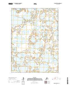
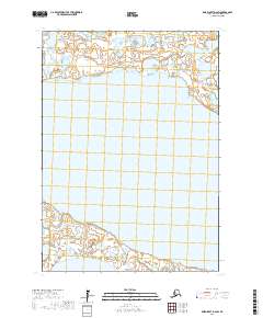
2017 Map of Baird Inlet D-3 NE
USGS Topo · Published 2017About this map
Vast interconnected water bodies and tundra wetlands dominate this 2017 survey of the Bethel Census Area in Alaska. The landscape is defined by its complex hydrography, where countless unnamed lakes and ponds fill the depressions between low-lying land. Mapping this territory required detailed survey work across the public land survey system grids of T11n R77w, T11n R76w, and T10n R77w. This specific region of the Baird Inlet shows a environment where land and water are constantly shifting, with no established roads or permanent settlements recorded within these boundaries. The map serves as a primary record of the natural hydrology and contour intervals in a portion of the state where the seasonal movement of water is the primary architect of the geography. Researchers can examine the intricate shorelines throughout T10n R76w and into T9n R77w and T9n R76w.
Find a feature on this map
6 named features on this map. Tap any name to fly to it.
Don’t see what you’re looking for? This feature index may not catch every label — zoom into the map to look around manually.
Map Details
Editions of this 2017 Baird Inlet D-3 NE Map
This is the sole edition of this map. No revisions or reprints were ever made.
Other maps of this area

1951 · Marshall
USGS Topo · 1:250,000

1951 · Baird Inlet
USGS Topo · 1:250,000

1954 · Marshall A-2
USGS Topo · 1:63,360

1954 · Marshall A-3
USGS Topo · 1:63,360

1954 · Marshall
USGS Topo · 1:250,000

1954 · Baird Inlet
USGS Topo · 1:250,000
1954 · Baird Inlet D-3
USGS Topo · 1:63,360
1954 · Baird Inlet D-2
USGS Topo · 1:63,360
2017 · Baird Inlet D-3 SE
USGS Topo · 1:25,000
2017 · Baird Inlet D-2 SW
USGS Topo · 1:25,000