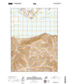
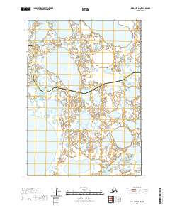
2020 Map of Baird Inlet D-7 SW
USGS Topo · Published 2020About this map
Mertarvik sits at the northern edge of this coastal landscape on Nelson Island, representing a contemporary period of relocation and community establishment in the Bethel Census Area. The topography transitions from the wetland-rich northern flats into the rising slopes of the island's interior, where drainage is defined by the winding paths of Takechak Cr and Chakchak Cr. This geographic record reflects the region's unique subsistence patterns and the necessary movements of its inhabitants between the mainland and the island's more stable ground. The map details the precise elevations and hydrographic features that dictate life and travel in this part of the Yukon-Kuskokwim Delta.
Find a feature on this map
9 named features on this map. Tap any name to fly to it.
Don’t see what you’re looking for? This feature index may not catch every label — zoom into the map to look around manually.
Map Details
Editions of this 2020 Baird Inlet D-7 SW Map
This is the sole edition of this map. No revisions or reprints were ever made.
Other maps of this area

1951 · Baird Inlet
USGS Topo · 1:250,000

1954 · Baird Inlet C-7
USGS Topo · 1:63,360

1954 · Baird Inlet D-7
USGS Topo · 1:63,360

1954 · Baird Inlet
USGS Topo · 1:250,000

1954 · Baird Inlet C-8
USGS Topo · 1:63,360

1954 · Baird Inlet D-8
USGS Topo · 1:63,360
2020 · Baird Inlet C-7 NE
USGS Topo · 1:25,000
2020 · Baird Inlet D-8 NE
USGS Topo · 1:25,000
2020 · Baird Inlet C-8 NE
USGS Topo · 1:25,000
2020 · Baird Inlet D-7 NW
USGS Topo · 1:25,000