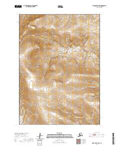
2020 Map of Baird Inlet C-8 NE
USGS Topo · Published 2020About this map
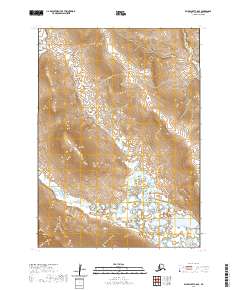
Nelson Island dominates this 2020 topographic survey, revealing the intricate water systems that define this part of the Bethel Census Area. The landscape is characterized by its hydraulic complexity, where the Umangnak River and Talarhun River snake across the southern and eastern reaches, while Isiktok Cr drains the northwestern elevations. This map illustrates the transition from the rolling interior of the island down to the lower alluvial plains where major rivers begin to broaden. The absence of modern roads or permanent settlements highlights the wilderness character of the region, emphasizing the primary role of natural waterways as the geographic anchors for navigation and resource access in the Alaskan tundra.
Find a feature on this map
13 named features on this map. Tap any name to fly to it.
Don’t see what you’re looking for? This feature index may not catch every label — zoom into the map to look around manually.
Map Details
Editions of this 2020 Baird Inlet C-8 NE Map
This is the sole edition of this map. No revisions or reprints were ever made.
Other maps of this area

1951 · Baird Inlet
USGS Topo · 1:250,000

1954 · Baird Inlet C-7
USGS Topo · 1:63,360

1954 · Baird Inlet D-7
USGS Topo · 1:63,360

1954 · Baird Inlet
USGS Topo · 1:250,000

1954 · Baird Inlet C-8
USGS Topo · 1:63,360

1954 · Baird Inlet D-8
USGS Topo · 1:63,360
2020 · Baird Inlet D-8 SW
USGS Topo · 1:25,000
2020 · Baird Inlet C-8 SW
USGS Topo · 1:25,000
2020 · Baird Inlet C-8 NW
USGS Topo · 1:25,000
2020 · Baird Inlet C-8 SE
USGS Topo · 1:25,000