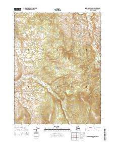
2015 Map of Baird Mountains A-1 SE
USGS Topo · Published 2015About this map
Great Kobuk Sand Dunes dominate the northeastern corner of this 2015 survey, illustrating a rare Arctic desert landscape within the Kobuk Valley National Park. The terrain is defined by undulating sand formations and small, scattered kettle lakes that dot the valley floor. Toward the east, the drainage of Kavet Cr winds through the topography, marking one of the few named watercourses in this protected wilderness. This USGS topographic study reflects the land as it appeared in the early 21st century, strictly bound by the township divisions of t20n r3w, t20n r2w, t19n r3w, and t19n r2w.
Find a feature on this map
7 named features on this map. Tap any name to fly to it.
Don’t see what you’re looking for? This feature index may not catch every label — zoom into the map to look around manually.
Map Details
Editions of this 2015 Baird Mountains A-1 SE Map
This is the sole edition of this map. No revisions or reprints were ever made.
Other maps of this area

1951 · Baird Mountains
USGS Topo · 1:250,000

1951 · Selawik
USGS Topo · 1:250,000

1951 · Shungnak
USGS Topo · 1:250,000

1951 · Ambler River
USGS Topo · 1:250,000

1955 · Shungnak
USGS Topo · 1:250,000

1955 · Baird Mountains A-1
USGS Topo · 1:63,360

1955 · Ambler River A-6
USGS Topo · 1:63,360

1955 · Shungnak D-6
USGS Topo · 1:63,360
1955 · Selawik D-1
USGS Topo · 1:63,360

1956 · Ambler River
USGS Topo · 1:250,000