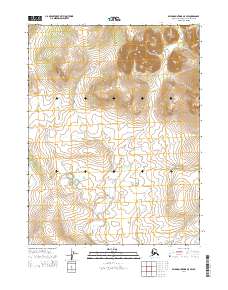
2014 Map of Baird Mountains A-5 SW
USGS Topo · Published 2014About this map
The northern reaches of the Amaouk Creek drainage dominate the southeast corner of this Arctic terrain within the Northwest Arctic Borough. The landscape transitions from relatively low-lying wetlands and complex hydrography in the south to significant topographic elevations in the northeast. This portion of the Baird Mountains is organized by the Public Land Survey System into several townships, including t20n r13w, t20n r12w, t19n r13w, and t19n r12w. The survey highlights the remote character of this Alaskan interior, where natural watercourses and the relief of unnamed ridges define the environment without the presence of established roads or permanent settlements.
Find a feature on this map
5 named features on this map. Tap any name to fly to it.
Don’t see what you’re looking for? This feature index may not catch every label — zoom into the map to look around manually.
Map Details
Editions of this 2014 Baird Mountains A-5 SW Map
This is the sole edition of this map. No revisions or reprints were ever made.
Other maps of this area

1951 · Baird Mountains
USGS Topo · 1:250,000

1951 · Selawik
USGS Topo · 1:250,000

1951 · Selawik D-6
USGS Topo · 1:63,360

1952 · Selawik D-6
USGS Topo · 1:63,360

1955 · Selawik D-5
USGS Topo · 1:63,360
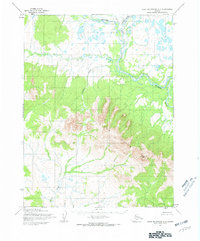
1955 · Baird Mountains A-5
USGS Topo · 1:63,360
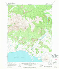
1955 · Baird Mountains A-6
USGS Topo · 1:63,360

1956 · Baird Mountains
USGS Topo · 1:250,000

1957 · Selawik
USGS Topo · 1:250,000

1965 · Baird Mountains
USGS Topo · 1:250,000