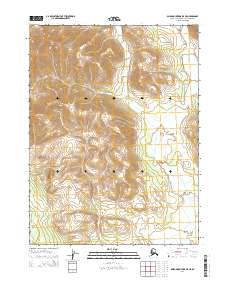
2014 Map of Baird Mountains B-5 NE
USGS Topo · Published 2014About this map
Baird Mountains dominate this 2014 survey of the Northwest Arctic Borough, where high ridgelines overlook the drainage of the N Fork Squirrel River. This map captures a landscape defined by its hydrography and elevation, showing the river winding through the eastern portion of the quadrangle while peaks and saddles define the central and western terrain. The absence of named settlements or infrastructure reflects the wilderness character of this region of Alaska, making it a critical record for understanding the natural geography and water systems before any potential future developments or changes in the Arctic environment. Geographers and naturalists can trace the detailed contour patterns that define the Baird Mountains and their relationship to the N Fork Squirrel River basin.
Find a feature on this map
6 named features on this map. Tap any name to fly to it.
Don’t see what you’re looking for? This feature index may not catch every label — zoom into the map to look around manually.
Map Details
Editions of this 2014 Baird Mountains B-5 NE Map
This is the sole edition of this map. No revisions or reprints were ever made.
Other maps of this area

1951 · Baird Mountains
USGS Topo · 1:250,000

1955 · Baird Mountains C-4
USGS Topo · 1:63,360
1955 · Baird Mountains C-5
USGS Topo · 1:63,360
1955 · Baird Mountains B-5
USGS Topo · 1:63,360
1955 · Baird Mountains B-4
USGS Topo · 1:63,360

1956 · Baird Mountains
USGS Topo · 1:250,000

1965 · Baird Mountains
USGS Topo · 1:250,000
2014 · Baird Mountains C-5 SE
USGS Topo · 1:25,000
2014 · Baird Mountains C-4 SW
USGS Topo · 1:25,000
2014 · Baird Mountains B-5 SE
USGS Topo · 1:25,000