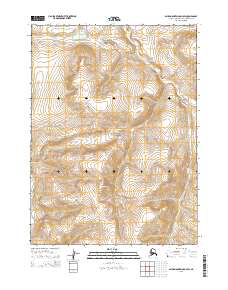
2015 Map of Baird Mountains D-3 SW
USGS Topo · Published 2015About this map
Noatak National Preserve encompasses the central portion of this wilderness landscape in the Arctic. The terrain is defined by the Angayukalik Hills and a network of high-latitude drainage systems that feed into the Brooks Range watershed. This 2015 survey illustrates a land completely devoid of permanent human infrastructure, highlighting the extreme seclusion of the Northwest Arctic Borough. Waterways such as Sapun Cr, Konayat Cr, and Nakolikurok Cr carve through the topography, serving as the primary geographical markers in an area defined by its natural state. The map provides a detailed view of the Public Land Survey System grid as it interfaces with these raw natural features, offering a precise look at the township and range boundaries that overlay this protected preserve.
Find a feature on this map
11 named features on this map. Tap any name to fly to it.
Don’t see what you’re looking for? This feature index may not catch every label — zoom into the map to look around manually.
Map Details
Editions of this 2015 Baird Mountains D-3 SW Map
This is the sole edition of this map. No revisions or reprints were ever made.
Other maps of this area

1951 · Baird Mountains
USGS Topo · 1:250,000

1955 · Baird Mountains D-4
USGS Topo · 1:63,360

1955 · Baird Mountains D-3
USGS Topo · 1:63,360

1955 · Baird Mountains C-4
USGS Topo · 1:63,360

1955 · Baird Mountains C-3
USGS Topo · 1:63,360

1956 · Baird Mountains
USGS Topo · 1:250,000

1965 · Baird Mountains
USGS Topo · 1:250,000
2015 · Baird Mountains C-3 NE
USGS Topo · 1:25,000
2015 · Baird Mountains D-4 NE
USGS Topo · 1:25,000
2015 · Baird Mountains C-3 NW
USGS Topo · 1:25,000