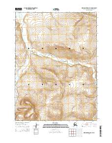
2015 Map of Baird Mountains D-4 SE
USGS Topo · Published 2015About this map
The Noatak National Preserve encompasses most of this landscape within the Northwest Arctic Borough, protecting a wilderness of complex hydrology and high-altitude terrain. The Nakolik River flows along the western edge of the quadrangle, carving a path through the northern reaches of the Angayukalik Hills. This 2015 survey reveals a terrain defined by its sharp elevation changes and the intricate drainage patterns of Nakolikurok Creek and its southern branch, Nakolikurok Cr. Mapping from the BLM and the Alaska Department of Transportation details the Public Land Survey System grid across these townships, including t28n r9w and t28n r8w, illustrating how federal boundaries overlay this remote interior watershed.
Find a feature on this map
11 named features on this map. Tap any name to fly to it.
Don’t see what you’re looking for? This feature index may not catch every label — zoom into the map to look around manually.
Map Details
Editions of this 2015 Baird Mountains D-4 SE Map
This is the sole edition of this map. No revisions or reprints were ever made.
Other maps of this area

1951 · Baird Mountains
USGS Topo · 1:250,000

1955 · Baird Mountains D-4
USGS Topo · 1:63,360

1955 · Baird Mountains D-3
USGS Topo · 1:63,360

1955 · Baird Mountains C-4
USGS Topo · 1:63,360

1955 · Baird Mountains C-3
USGS Topo · 1:63,360

1956 · Baird Mountains
USGS Topo · 1:250,000

1965 · Baird Mountains
USGS Topo · 1:250,000
2014 · Baird Mountains D-4 NW
USGS Topo · 1:25,000
2014 · Baird Mountains D-4 SW
USGS Topo · 1:25,000
2014 · Baird Mountains C-4 NW
USGS Topo · 1:25,000