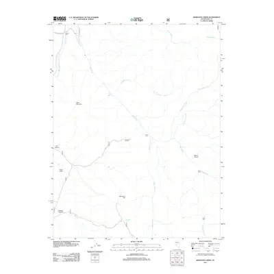
2011 Map of Bakeoven Creek
USGS Topo · Published 2011About this map
The Reese River flows through this arid landscape in Nye County, tracing a path that has historically dictated settlement and transit in this part of Nevada. Cattle ranching and seasonal grazing are the primary human imprints on the land, evidenced by several scattered outposts and infrastructure. Towards the northwest, Warners Ranch sits near the headwaters of Indian Creek, while central waypoints like the Lower Corral and the Cow Canyon Trailhead mark the junction of primitive roads and wilderness access points.
Find a feature on this map
22 named features on this map. Tap any name to fly to it.
Don’t see what you’re looking for? This feature index may not catch every label — zoom into the map to look around manually.
Map Details
Editions of this 2011 Bakeoven Creek Map
This is the sole edition of this map. No revisions or reprints were ever made.
Other maps of this area

1907 · Tonopah
USGS Topo · 1:250,000

1908 · Tonopah
USGS Topo · 1:250,000

1948 · Ione
USGS Topo · 1:62,500

1950 · Ione
USGS Topo · 1:62,500

1956 · Tonopah
USGS Topo · 1:250,000

1959 · Tonopah
USGS Topo · 1:250,000

1962 · Tonopah
USGS Topo · 1:250,000
1979 · Corral Wash
USGS Topo · 1:24,000
1979 · Toiyabe Peak
USGS Topo · 1:24,000
1980 · Arc Dome
USGS Topo · 1:24,000