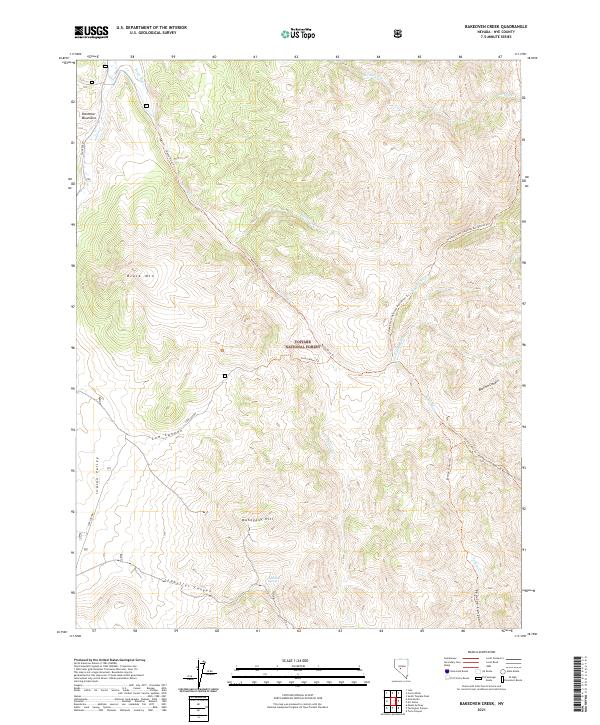
2021 Map of Bakeoven Creek
USGS Topo · Published 2021About this map
The Toiyabe National Forest landscape of Central Nevada is defined by the high-elevation drainages and steep ridges of the Shoshone Mountains. This 2021 survey traces the Reese River as it winds through the northern section of the map, while the Tolyabe Crest National Recreation Trl follows the high ridgelines to the east. The terrain is marked by significant vertical relief, climbing from the wide expanse of Indian Valley in the west toward prominent summits like Black Mtn and Mahogany Hill.
Find a feature on this map
31 named features on this map. Tap any name to fly to it.
Don’t see what you’re looking for? This feature index may not catch every label — zoom into the map to look around manually.
Map Details
Editions of this 2021 Bakeoven Creek Map
This is the sole edition of this map. No revisions or reprints were ever made.
Other maps of this area

1907 · Tonopah
USGS Topo · 1:250,000

1908 · Tonopah
USGS Topo · 1:250,000

1948 · Ione
USGS Topo · 1:62,500

1950 · Ione
USGS Topo · 1:62,500

1956 · Tonopah
USGS Topo · 1:250,000

1959 · Tonopah
USGS Topo · 1:250,000

1962 · Tonopah
USGS Topo · 1:250,000
1979 · Corral Wash
USGS Topo · 1:24,000
1979 · Toiyabe Peak
USGS Topo · 1:24,000
1980 · Arc Dome
USGS Topo · 1:24,000