
1901 Map of Baker City
USGS Topo · Published 1901About this map
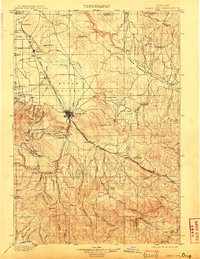
Baker City serves as the industrial and transportation hub for this 1898-1899 survey, situated at the junction of the Oregon Railroad and Navigation Company and the narrow-gauge Sumpter Valley Railroad. The landscape reflects a dual economy of valley ranching and high-desert mining, particularly evident at Virtue Flat where the Virtue Mine and Flagstaff Mine are located. To the west, the foothills of the Blue Mountains are etched with gold-era remnants like Auburn, while the broad Baker Valley is dotted with small agricultural settlements such as Wingville and Pocahontas. The intricate network of gulches, including California Gulch and Washington Gulch, highlights the intensive search for minerals that defined the region's development. This survey captures the county seat just as it had matured into a regional powerhouse, fueled by the surrounding river valleys and mineral-rich ridges.
Find a feature on this map
91 named features on this map. Tap any name to fly to it.
Don’t see what you’re looking for? This feature index may not catch every label — zoom into the map to look around manually.
Map Details
Editions of this 1901 Baker City Map
4 editions found
Other maps of this area

1901 · Sumpter
USGS Topo · 1:125,000

1906 · Telocaset
USGS Topo · 1:125,000

1908 · Ironside Mountain
USGS Topo · 1:125,000

1915 · Pine
USGS Topo · 1:125,000

1951 · Huntington
USGS Topo · 1:62,500

1953 · Pendleton
USGS Topo · 1:250,000

1954 · Eagle Cap
USGS Topo · 1:62,500

1955 · Baker
USGS Topo · 1:250,000

1955 · Grangeville
USGS Topo · 1:250,000

1955 · Canyon City
USGS Topo · 1:250,000