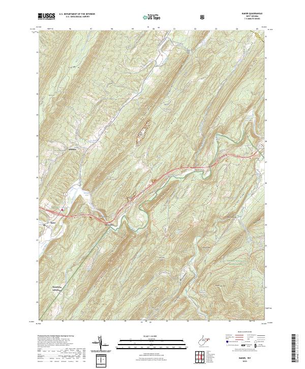
2023 Map of Baker
USGS Topo · Published 2023About this map
Baughman Settlement and the mountain community of McCauley anchor this detailed study of the Appalachian landscape in Hardy County. The Lost River winds through the valley floor, eventually meeting the Cacapon River at the eastern edge of the quadrangle. The terrain is defined by a series of prominent ridges, including Hanging Rock Ridge and Warden Ridge, which flank the narrow agricultural corridors of Cave Valley and Dutch Hollow. Historical land use is visible through family-named landmarks and water sources such as Baker Mine Spring, Steacy Conrad Spring, and Miller Spring. Much of the southern and eastern territory is protected within the George Washington National Forest, where a network of primitive paths like the Bucktail Trl and Long Mountain Trl provides access to summits like Halfmoon Mtn and Mollys Hill.
Find a feature on this map
84 named features on this map. Tap any name to fly to it.
Don’t see what you’re looking for? This feature index may not catch every label — zoom into the map to look around manually.
Map Details
Editions of this 2023 Baker Map
This is the sole edition of this map. No revisions or reprints were ever made.
Other maps of this area

1891 · Romney
USGS Topo · 1:125,000

1892 · Woodstock
USGS Topo · 1:125,000

1920 · Moorefield
USGS Topo · 1:62,500

1921 · Orkney Springs
USGS Topo · 1:48,000

1921 · Moorefield
USGS Topo · 1:48,000

1922 · Moorefield
USGS Topo · 1:62,500

1922 · Wardensville
USGS Topo · 1:62,500

1923 · Orkney Springs
USGS Topo · 1:62,500

1923 · Edinburg
USGS Topo · 1:62,500

1924 · Wardensville
USGS Topo · 1:62,500