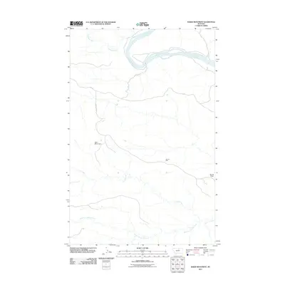
2011 Map of Baker Monument
USGS Topo · Published 2011About this map
The Missouri River winds through the northern portion of this Fergus County landscape, defining the hydrology of a region shaped by significant drainage systems. To the south, the expansive network of Two Calf Creek and the South Fork Two Calf Creek dominates the terrain, illustrating the complex watershed patterns found in this part of Montana. The eponymous Baker Monument stands as a primary landmark in the western section, while the eastern reaches are defined by the elevation of Barnes Ridge.
Find a feature on this map
10 named features on this map. Tap any name to fly to it.
Don’t see what you’re looking for? This feature index may not catch every label — zoom into the map to look around manually.
Map Details
Editions of this 2011 Baker Monument Map
This is the sole edition of this map. No revisions or reprints were ever made.
Other maps of this area

1943 · Landusky
USGS Topo · 1:125,000

1954 · Cow Island
USGS Topo · 1:24,000

1954 · Baker Monument
USGS Topo · 1:24,000

1954 · Sturgeon Island
USGS Topo · 1:24,000

1954 · Grand Island
USGS Topo · 1:24,000

1954 · Lewistown
USGS Topo · 1:250,000

1959 · Lewistown
USGS Topo · 1:250,000
1971 · Shetland Divide
USGS Topo · 1:24,000

1984 · Zortman
USGS Topo · 1:100,000

1985 · Thompson Coulee
USGS Topo · 1:24,000