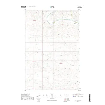
2020 Map of Baker Monument
USGS Topo · Published 2020About this map
The Missouri River carves a deep, winding channel through the northern reaches of this Montana landscape, marking the convergence of Blaine, Fergus, and Phillips counties. This 2020 survey illustrates a sparsely populated region where geography is defined by significant drainage systems, notably Two Calf Cr and its S Fork Two Calf Cr. The high, dissected plateau south of the river is punctuated by the Baker Monument, a prominent topographical landmark that overlooks the intricate network of coulees and ridges typical of the Missouri Breaks region.
Find a feature on this map
16 named features on this map. Tap any name to fly to it.
Don’t see what you’re looking for? This feature index may not catch every label — zoom into the map to look around manually.
Map Details
Editions of this 2020 Baker Monument Map
This is the sole edition of this map. No revisions or reprints were ever made.
Other maps of this area

1943 · Landusky
USGS Topo · 1:125,000

1954 · Cow Island
USGS Topo · 1:24,000

1954 · Baker Monument
USGS Topo · 1:24,000

1954 · Sturgeon Island
USGS Topo · 1:24,000

1954 · Grand Island
USGS Topo · 1:24,000

1954 · Lewistown
USGS Topo · 1:250,000

1959 · Lewistown
USGS Topo · 1:250,000
1971 · Shetland Divide
USGS Topo · 1:24,000

1984 · Zortman
USGS Topo · 1:100,000

1985 · Thompson Coulee
USGS Topo · 1:24,000