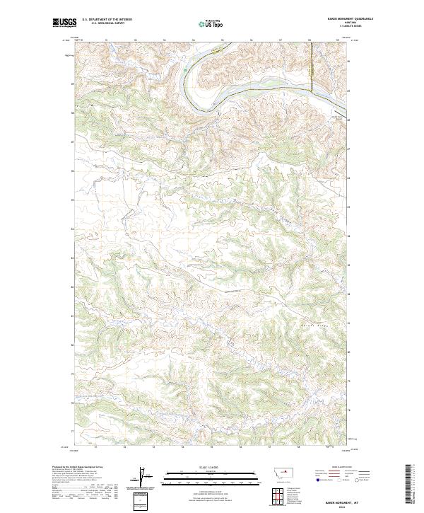
2024 Map of Baker Monument
USGS Topo · Published 2024About this map
The Missouri Wild and Scenic River carves a winding path through the northern portion of this Fergus County landscape, where the deep drainage of Reed Coulee meets the river's southern bank. This contemporary survey captures a protected wilderness area dominated by the Upper Missouri River Breaks National Monument, a region defined by its complex network of coulees and ridges that descend toward the water. Settlement remains sparse, with the Miller Farm Airport standing as one of the few developed landmarks in the northeast corner near the Blaine and Phillips county lines.
Find a feature on this map
20 named features on this map. Tap any name to fly to it.
Don’t see what you’re looking for? This feature index may not catch every label — zoom into the map to look around manually.
Map Details
Editions of this 2024 Baker Monument Map
This is the sole edition of this map. No revisions or reprints were ever made.
Other maps of this area

1943 · Landusky
USGS Topo · 1:125,000

1954 · Cow Island
USGS Topo · 1:24,000

1954 · Baker Monument
USGS Topo · 1:24,000

1954 · Sturgeon Island
USGS Topo · 1:24,000

1954 · Grand Island
USGS Topo · 1:24,000

1954 · Lewistown
USGS Topo · 1:250,000

1959 · Lewistown
USGS Topo · 1:250,000
1971 · Shetland Divide
USGS Topo · 1:24,000

1984 · Zortman
USGS Topo · 1:100,000

1985 · Thompson Coulee
USGS Topo · 1:24,000