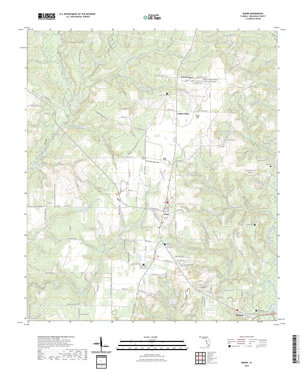
2024 Map of Baker
USGS Topo · Published 2024About this map
The Yellow River and Blackwater River systems define the landscape of northern Florida, where the communities of Baker and Milligan serve as central points for the surrounding rural area. This recent survey highlights a dense network of watercourses, including Panther Creek, Penny Creek, and the uniquely named Griffith Ferry Stretch on the river. The region is notable for its numerous family and community cemeteries, such as Aubrey Jordan Memorial Cem, Cobb Cem, and the Pilgrims Rest Baptist Church Cem, which provide significant value for genealogical research. Aviation is represented by several local strips, including Dotson Airport and Skypark Estates Owners Association Airport. The terrain rises toward Nubbin Ridge in the north, while the southern reaches are dominated by the wetlands and branches feeding the major rivers, illustrating the enduring agricultural and pastoral character of Okaloosa County.
Find a feature on this map
127 named features on this map. Tap any name to fly to it.
Don’t see what you’re looking for? This feature index may not catch every label — zoom into the map to look around manually.
Map Details
Editions of this 2024 Baker Map
This is the sole edition of this map. No revisions or reprints were ever made.
Other maps of this area

1934 · Holt
USGS Topo · 1:48,000

1934 · Harold
USGS Topo · 1:62,500

1937 · Holt
USGS Topo · 1:62,500

1937 · Harold
USGS Topo · 1:62,500

1938 · Harold
USGS Topo · 1:62,500

1948 · Munson
USGS Topo · 1:62,500

1949 · Crestview
USGS Topo · 1:62,500

1950 · Munson
USGS Topo · 1:62,500

1951 · Crestview
USGS Topo · 1:62,500

1956 · Holt
USGS Topo · 1:62,500